
The Skyscraper Museum is devoted to the study of high-rise building, past, present, and future. The Museum explores tall buildings as objects of design, products of technology, sites of construction, investments in real estate, and places of work and residence. This site will look better in a browser that supports web standards, but it is accessible to any browser or Internet device.
Rescued from Urban Oblivion:
The Digital Reconstruction of the Heritage Trails Site Markers
The 1997 Markers
With the exception of the site marker preserved in the 9/11 Memorial and Museum, none of the original Heritage Trails panels have survived. In order to accurately reconstruct the original 42 panels, The Skyscraper Museum had to track down and acquire digital files from several sources and piece them together in a sort of digital archeology. No set of files was complete, with all images and fonts in the original format, so some detective work was required to retrieve them from having fallen, as Richard Kaplan wrote of the 1976 Bicentennial markers, “into an urban oblivion.”
VIEW THE 1997 PANELS VIEW THE 2017 PANELS
GREEN GREEN
BLUE BLUE
ORANGE ORANGE
RED RED
The 2017 Markers
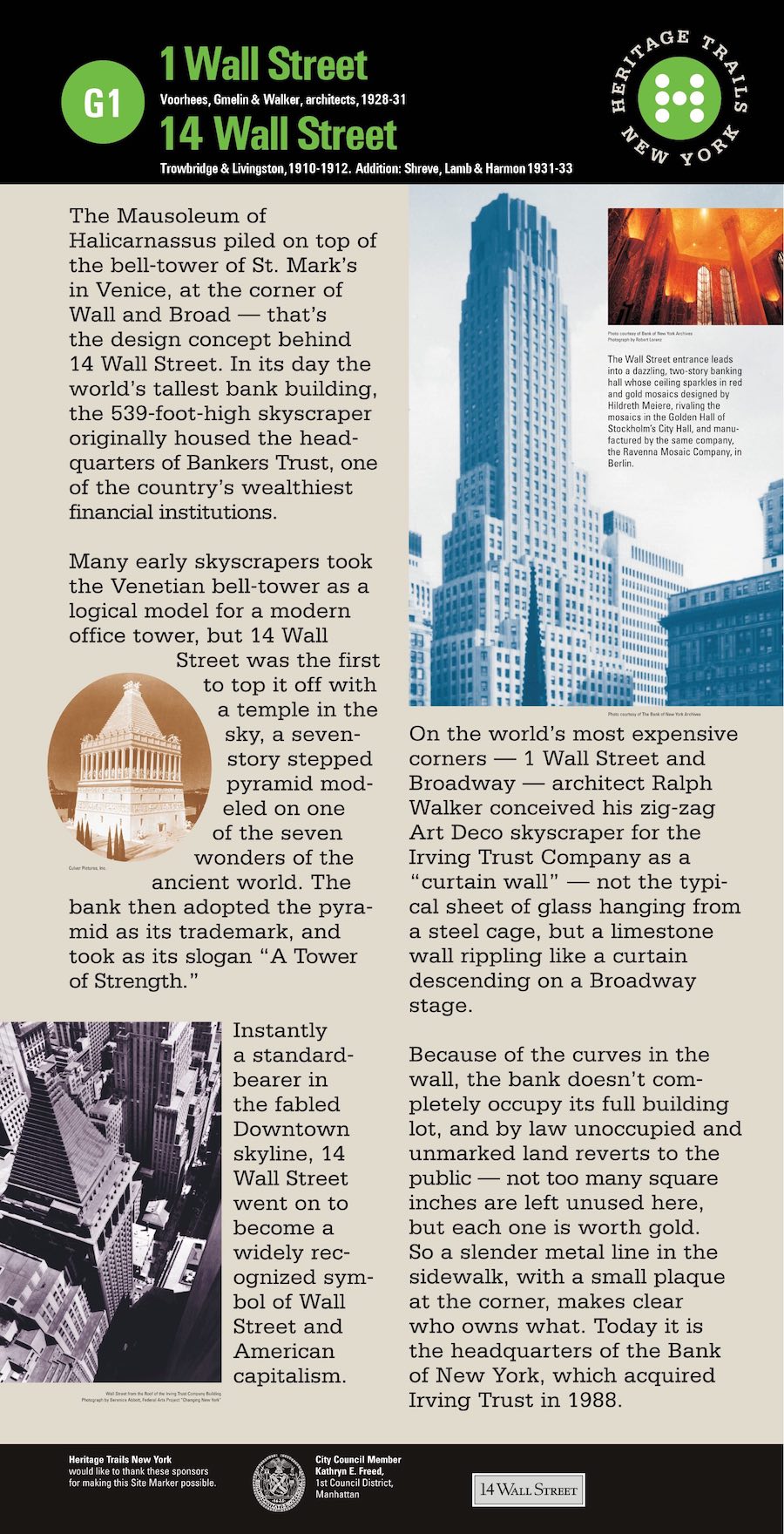
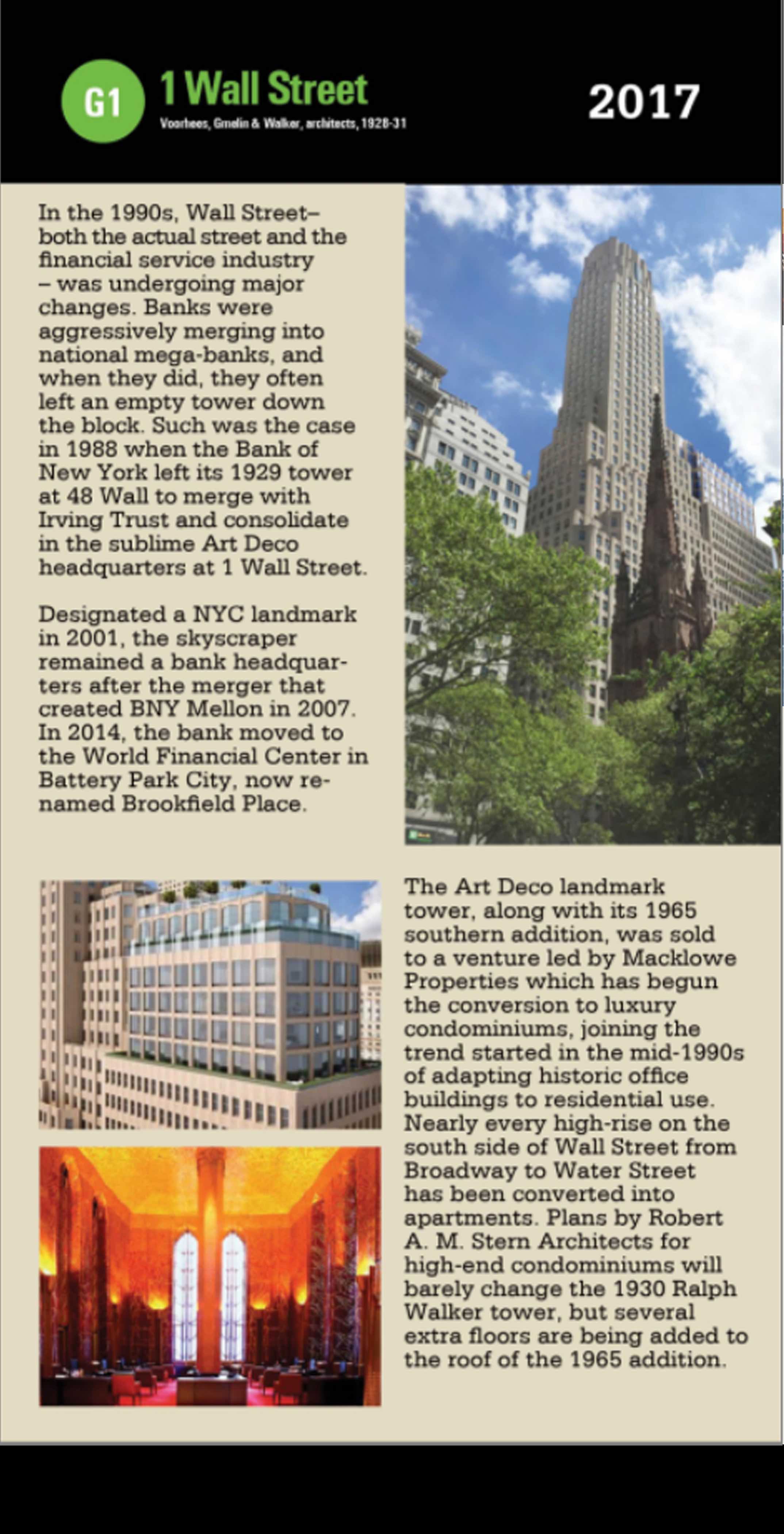
After reconstructing the original Heritage Trails panels, it seemed obvious that we should update them, recounting what had happened on the site in the twenty years since 1997. Some changes were literally epochal: the World Trade Center. Others collectively revealed trends in Downtown’s shifting identity, such as the many conversions of skyscraper office buildings to residential use. Hurricane Sandy in 2012 sealed the fate of the Police Museum and severely diminished the South Street Seaport Museum. Some places, like Fraunces Tavern, changed little. Others, like the Battery, enjoyed a renaissance. The Skyscraper Museum acquired a permanent home in Battery Park City. These updated markers, in the same style as the originals, present short narrations of such significant changes to each site, and include up-to-date images of the site. While the 1997 markers present the long-term histories of Downtown’s landmarks, the 2017 markers are able to focus on the vibrant changes that historic lower Manhattan is undergoing today.
How We Reconstructed the Markers:
In order to reconstruct the original markers, several sources generously shared their files with the Skyscraper Museum. Chermayeff & Geismar (now Chermayeff & Geismar & Haviv), the design firm hired in July 1994 to create the graphic identity for Heritage Trails, did not have original files other than a collection of slides/ diapositives of stages of the project, including some of the markers installed on city sidewalks. The lead partner on the project, Keith Helmetag, left Chermayeff & Geismar to start his own firm, named C & G Partners.
He and his team kept substantial files from the Heritage Trails project, but only 12 of the 42 panels were included in their digital files,
most of which were in the 1990s software program Quark.
Another key source was the Downtown Alliance, the Business Improvement District (BID), which took over the administration of Heritage Trails in 2000. The BID had a near-complete set of files of the markers in .PDF and .EPS formats, but the files had lost vital font and layout information. Since the C & G Partners files contained information on the missing fonts and images, the markers could be accurately reconstructed in Illustrator from the two sources. A few of the Alliance’s files, mainly from the Red Trail, were available only as .PDFs, so the text in these files had to be rewritten line by line and certain images replaced. In the few cases where files were completely missing from the Downtown Alliance, an extracted version of the C & G Partners files were used.
Some slides of the early markers in situ allowed us to compare images and texts to confirm line breaks and layout of our reconstructions, but in fact there is no record of the installation of the majority of the markers. What survives today are the cast-iron stanchions, some of which carry the original historical information, while others have been repurposed. The maps have been redone – necessary post 9/11 – and the credits by the Alliance.
Additionally, there were several changes to the order of the trails in the early years, which required standardization. These can be discerned in the different maps and brochures produced by Heritage Trails between 1995 and 1999. The Museum used three main maps as a reference: the original map and brochure of 1995; a map copyrighted 1998 (which corresponds closely to the order of the trails as they were first physically installed in 1997); and a final version copyrighted 1999. The position of sites on the trails were changed from version to version, as with the Equitable Building, which was moved from the second stop on the Red Trail (R2) to the final stop on the Blue Trail (B8) between 1998 and 1999, thereby reordering the rest of the Red Trail. The Green Trail was almost entirely reordered between 1995 and the installation of the markers in 1997. The panels reproduced here align with the order of Heritage Trails in 1998.
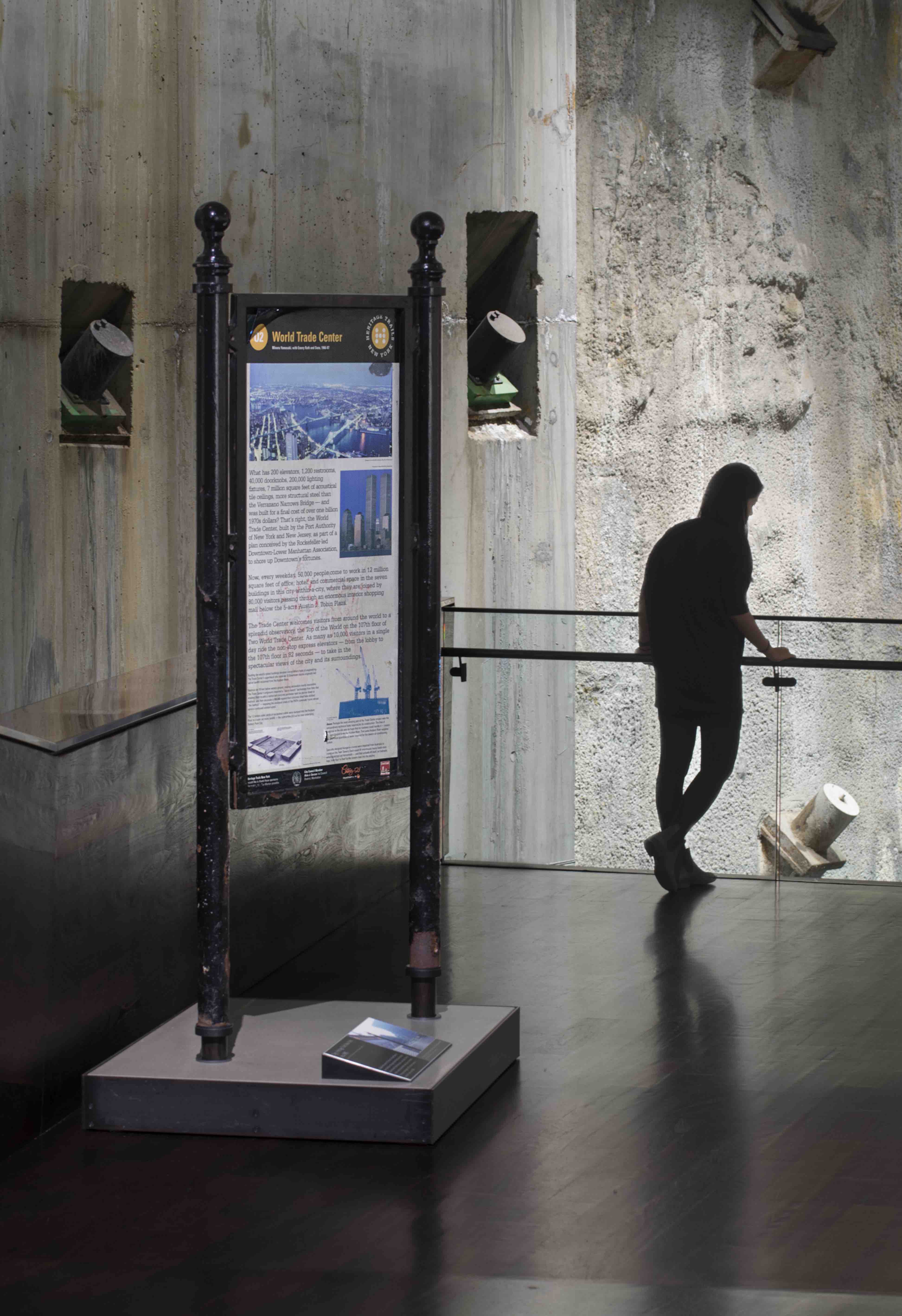
Ironically, the only original Heritage Trails marker that survives today stands in the entrance of the 9/11 National Memorial and Museum, having survived the fall of the Twin Towers. Indeed, it remained, barely noticed, on Church Street near the corner of Cortland Street through November 2003, when New York Times reporter David Dunlap wrote a poignant story about its origins as a Heritage Trails marker under the title,
"Stuck in the Present Tense, Pointing to the Twin Towers."
Not even this marker, though, exists in its first state on the map side, since in 2000, the Downtown Alliance replaced the Van Dam map with a more diagrammatic, figure-ground map that was marked with major sites and carried two rows of images of attractions on the bottom.